The weather will not resemble autumn as temperatures gradually rise until Saturday 12/10. According to the latest forecast data from meteo.gr / National Observatory of Athens, the atmospheric circulation in the next days will be favorable for the transport of warm gases to our country.
Therefore, temperatures are expected to reach 32-34 °C in most places, especially on Friday 11/10, when the peak of the heat wave is expected.
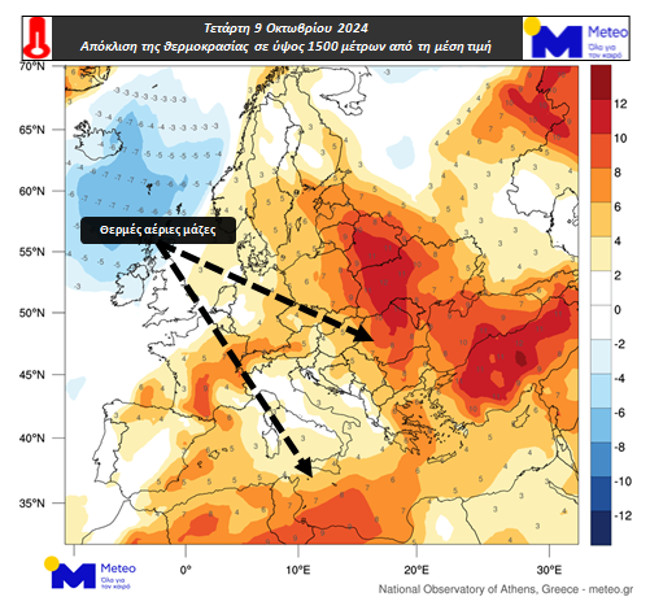
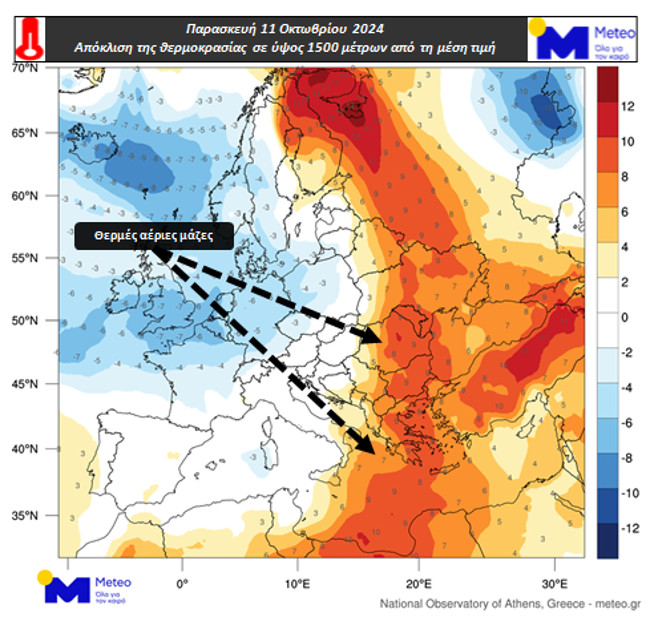
Graphs 1 and 2 show the deviation of temperature at approximately 1500 meters from the mean value for the period 1979-2010 on the afternoon of Wednesday 09/10 and Friday 11/10.
An altitude of 1500 meters is used to study temperature changes in the lower part of the atmosphere. Areas where the temperature is higher than the mean climate value are in orange/red and areas where it is lower are in blue/blue. Warm air masses are commonly found in the central and eastern parts of Europe and the Mediterranean.
It is worth noting that the final structure of temperature near land depends on many factors such as e.g. Presence/absence of clouds and phenomena and wind.
See weather maps

Temperature deviation from the 1979-2010 average value at about 1500 meters at noon on Wednesday 09/10

Temperature deviation from 1979-2010 average at about 1500 meters elevation on Friday 11/10 at noon
When will the temperature drop?
However, on Sunday, a drop in temperature is expected, according to Clearchos Marousakis. On his personal Facebook account on Tuesday morning, the meteorologist said:
“As our people say from the highest to the lowest and from the many to the few…
Weather reminiscent of summer over the next few days will bring us back to autumn”.
It comes with the post with a chart, according to which the temperature will drop on Sunday and not exceed 25 degrees Celsius.